Title Image

Regional Maps

23$

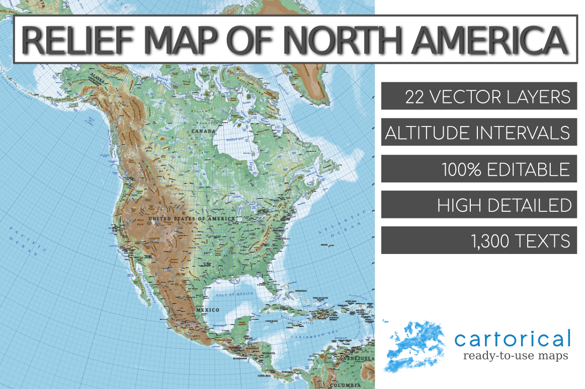
Relief Map of North America

Physical map of North America. Provides physical details, land elevations, minor islands, rivers, natural and artificial lakes and others features type. The map is fully vector, including shaded relief and elevation ranges represented by hypsometric tints.

23$

Relief Map of Europe

Physical map of Europe. Provides physical details, land elevations, minor islands, rivers, natural and artificial lakes and others features type. The map is fully vector, including shaded relief and elevation ranges represented by hypsometric tints.

15$

Vector Map of United States

Political vector map of USA multi-layered and scalable to whatever size you want without losing the quality. The map contain the three levels in the administrative divisions of the United States of America: states, counties, and cities, towns and villages.

23$

Europe Political Map

Large scale Europe political map multi-layered in editable vector format. Highly detailed, ideal for illustrations, prints and multimedia projects. 100% editable including font text for ease of use.

23$

Australia and New Zealand Political Map

Large scale Australasia political map (Australia and New Zealand) multi-layered in editable vector format. 100% editable. Map with towns, cities, major roads, railways and sea routes.

13$

Canada Political Map

Political vector map of Canada multi-layered and scalable. The map contain three levels in the administrative divisions of Canada: provinces and territories, census divisions, and cities, towns and villages.

23$

South Asia and Near East Political Map

Large scale South Asia and Near East political map multi-layered in editable vector format. 100% editable. Map with more than 1,000 cities, major roads, railways and sea routes.

23$

South East Asia Political Map

Large scale South East Asia political map multi-layered in editable vector format. 100% editable. Map with more than 1,400 cities, major roads, railways and sea routes.

23$

East Asia Political Map

Large scale East Asia political map multi-layered in editable vector format. 100% editable. Map with more than 2,000 cities, major roads, railways and sea routes.

23$

Central Asia Political Map

Large scale Central Asia political map multi-layered in editable vector format. 100% editable. Map with more than 600 cities, major roads, railways and sea routes.